
Intent
At Sowerby, through Geography we sow the seeds of success to grow courageous learners and provide meaningful opportunities for pupils to live out our core values of courage, resilience, acceptance, respect and kindness.
Our Geography curriculum is ambitious, broad and balanced, rooted in EYFS as the starting point, and aligned to the National Curriculum and the Elevate Curriculum Progression Model for Geography. It is coherently planned and sequenced so that pupils build knowledge and skills sequentially and cumulatively, with time to revisit key content and address gaps so learning is securely embedded, and teaching is adapted responsively so that all pupils can access, participate and achieve well.
Geography also strengthens strong foundations in communication and language, reading, writing and mathematics. Pupils learn and use precise subject vocabulary; read maps, atlases, diagrams and texts; write to explain, compare and evaluate; and apply mathematics through coordinates, scale and distance, and by collecting, presenting and interpreting data. Disadvantaged learners are supported by scaffolds, pre-teaching and flexible ways of recording where this can help pupils to be successful.
Implementation
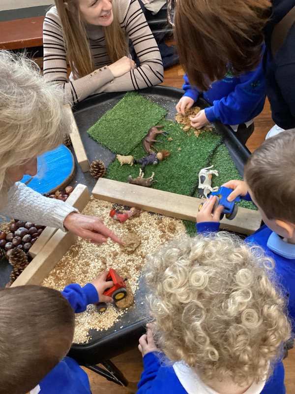
Geography begins in EYFS through Understanding the World, where children explore their immediate environment, notice similarities and differences between places, observe the natural world and begin to describe change. From Year 1 to Year 6, Geography is taught through carefully sequenced, blocked units (typically 5–6 weeks) using the Elevate Curriculum Progression, adapted into a two-year (A/B) cycle to support mixed-age classes while ensuring full coverage of National Curriculum objectives. Key knowledge, vocabulary and concepts are explicitly taught through knowledge organisers and modelling, and are revisited through planned retrieval so that learning is securely embedded and pupils remember more over time.
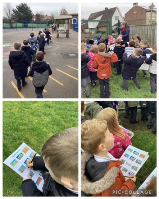
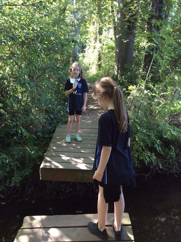
Teaching focuses on clear end points, with teachers checking understanding systematically, addressing misconceptions and adapting teaching so pupils can keep up with the intended curriculum. Lessons build strong subject knowledge alongside disciplinary thinking: pupils regularly interpret and create maps, use atlases, globes and aerial photographs, and apply geographical fieldwork skills through purposeful work in the school grounds and local area. Computing skills are used appropriately to support research and presentation, including digital mapping such as Google Earth, and pupils develop confidence in presenting geographical information through talk, writing, diagrams and data.
Fieldwork, first-hand experiences and enrichment are planned to deepen understanding and help pupils connect classroom learning to the wider world. Throughout units, barriers to learning are anticipated and removed through responsive teaching and well-matched support. We support children with special educational needs and those who may be disadvantaged by pre-teaching and overlearning key vocabulary, using dual coding and visuals, chunking instructions, scaffolding map work and writing tasks, offering flexible ways to record learning, and providing targeted adult support that promotes independence. High expectations are maintained and pupils are challenged through higher-order questioning and independent enquiry.
Assessment
Assessment for Geography is based on the key enquiry question for each unit. Teachers will assess using a range of methods. Teacher-assessed grades are given for Geography each term (3 times a year). Teachers use assessment to inform future planning and adapt their teaching for the needs of their class.
Impact
Pupils leave Sowerby as confident, curious geographers who know more, remember more and can do more over time. They can locate and describe a range of places and environments, explain key human and physical processes, and make meaningful links across units because knowledge and vocabulary are revisited and securely embedded. Pupils communicate their understanding using accurate geographical language through purposeful discussion and extended writing, and they apply mathematical thinking when using coordinates, scale and distance, and when presenting and interpreting data.
Pupils increasingly think and work like geographers: they read and create maps, use atlases, globes and aerial photographs accurately, and carry out fieldwork to collect, present and draw conclusions from evidence. They can explain what they have learned and apply it in unfamiliar contexts because they have regular opportunities to practise disciplinary skills and revisit key concepts. Leaders and teachers evaluate impact through pupil voice, work scrutiny, retrieval outcomes and termly teacher assessment linked to each unit enquiry question, using this information to refine curriculum delivery and address any gaps promptly so that all pupils achieve well from their starting points.